
Fahnen, Flaggen und Kalender bei Fanshop-Online.de bestellen
This page is part of © FOTW Flags Of The World website.FOTW beschäftigt sich mit der Wissenschaft der Vexillologie (Flaggenkunde).
Alle auf dieser Website dargebotenen Abbildungen dienen ausschließlich der Informationsvermittlung im Sinne der Flaggenkunde.
Wir distanziert uns ausdrücklich von allen hierauf dargestellten Symbolen verfassungsfeindlicher Organisationen.
Polderboards (The Netherlands)
Waterschappen
Last modified: 2018-12-15 by rob raeside
Keywords: polderboard |
Links: FOTW homepage |
search |
disclaimer and copyright |
write us |
mirrors
Other polderboards, arranged by province:
-
Drenthe: Drentse Aa, Noorderzijlvest
(part),
-
Fryslân: Amelander Grieën, Boarn
en Klif, Marne-Middelsee,
Middelsékrite,
Sevenwolden,
Stellingwerven,
Tusken
Waed en Ie, Waadkant,
Westergoa's
Iselmardiken,
-
Gelderland: Groot Maas en Waal, Linge,
Noord-Veluwe,
Oude
IJssel,
-
Groningen: Duurswold, Eemszijlvest,
Noorderzijlvest,
Oldambt,
Westerkwartier,
-
Limburg: Limburg, Maasterras,
Noord-Limburg,
-
Noord-Brabant: Aa, Alm,
Dommel,
Heusden
en Altena, Mark en Dintel,
-
Noord-Holland: Amstel en Gooi, Amstelland
polderboard, Haarlemmermeer,
Kennemerland
en West-Friesland, Lange Rond, 4
Noorderkoggen,
Noordhollands Noorderkwartier,
Purmer,
Schermer,
Waterland,
Waterlanden,
-
Overijssel: Bovenvecht, Regge
en Dinkel, Salland, Schipbeek,
-
Utrecht: Leidse Rijn, Proosdijlanden,
-
Zeeland: Hulster Ambacht, Noord-Beveland,
N/Z
Beveland, Schouwen-Duiveland, Vrije
van Sluis, Walcheren,
Wilhelminapolder,
Zeeuws-Vlaanderen,
-
Zuid-Holland: Aarlanden, Alblasserwaard
en Vijfheerenlanden, Brielse Dijkkring,
Delfland,
Goeree-Overflakkee,
Gouwelanden,
Groote Waard,
Krimpenerwaard,
Meer
en Woude,
Nederwaard,
Noordwoude,
Overwaard,
Rijnland,
Schieland,
Wilck
en Wiericke,
Woerden,
IJsselmonde,
See also:
Polderboards (Waterschappen) - Introduction
Polderboards are responsible for water-management in s certain area. When
the Netherlands emerged from the sea there were conficting interests as
to who was responsible for dike-maintenance; local lords couldn't care
less about the dike of their neighbours, since they were mostly their enemies.
In the 12-14th centuries continuous dikes around all of the Netherlands
were built (let's say from Duinkerken till Emden), and agreements were
made among the "dijkgraven" (dike-counts) for maintenance. The necessity
for this was well known because of the great flooding disaster in the Middle
Ages. When great floods threatened the country "dijkgraven" were
entitled to force every landowner to protect the dikes. Later this power
was given to organisations, named "waterschappen" (polderboards),
with local name-variations (heemraadschap, hoogheemraadschap,
etcetera).
During the ages the attention shifted from dike-protection to canal-digging,
and the provision of sweet water. (when I was young we drank from a dug
well, where frogs and salamanders and other creeping crawlies swam in,
only in 1949 we got water from the tap). Now the polderboards, though separate
entities, are one huge organisation, with in the future the awkward task
of providing us with ample sweet water for our yakusa's, swimming-pools
and cuppa's.
In 1969 Mr. A.J. Beenhakker presented 28 flags of polderboards during
a meeting of European Flagfriends in Temse, Belgium. His article is not
available anymore. On the 6th congress of the ICV in 1975, organized by
the Stichting voor Banistiek en Heraldiek, on the IJsselmeer, the
"Hoogheemraadschap" Waterland in Monnickendam greeted the 150 participants
with 30 masted "polderboardflags". Although these flags are seldom seen
they are always used on "schouwboten" (inspection-ships).
Jarig Bakker, 2 Dec 2003
De Runde polderboard
![[De Runde polderboard]](../images/n/nl~pb-ru.gif) image by Jarig Bakker, 2 Dec 2003
image by Jarig Bakker, 2 Dec 2003
Dutch name: Waterschap De Runde; seat Emmer Compascuum, in SE Drenthe
province.
Flag: wavy of horizontal stripes white - black - white - red - white
- black - white, proportioned 30:2:6:5:6:3:30.
The Runde is one of the lesser known mighty rivers of Drenthe. On Ralf
Hartemink's site one can read that black is representing the peat-digging
(and possibly the exploitation of oil in Schoonebeek), while the Runde
is colored red by iron-deposits.
Source Vexilla Nostra #122, Sep-Oct 1982.
text: Kl. Sierksma; image: H. van Heijningen.
Jarig Bakker, 2 Dec 2003
Former Waterschap: de Middelsékrite
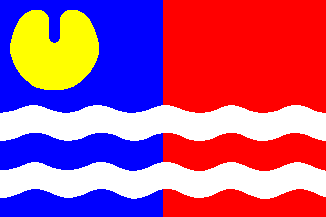 image by Gerard van der Vaart, 11 Feb 2001
Waterschap Lauwerswâlden (FR)
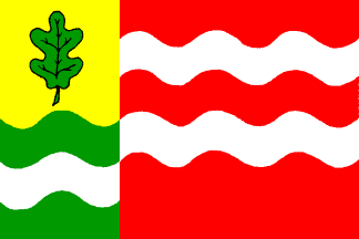 image by Gerard van der Vaart, 11 Feb 2001
Waterschap de Brielse Dijkring (ZH)
 image by Gerard van der Vaart, 11 Feb 2001
Waterschap Groot Salland (OV)
 image by Gerard van der Vaart, 11 Feb 2001
Former Waterschap: Dollardzijlvest (GR)
 image by Gerard van der Vaart, 11 Feb 2001
Waterschap Land van Nassau (NB)
 image by Gerard van der Vaart, 11 Feb 2001
Waterschap Mark en Weerijs (NB)
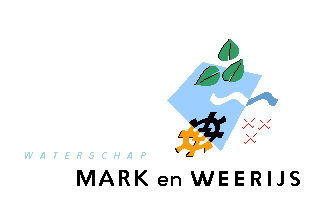 image by Gerard van der Vaart, 11 Feb 2001
Former Heemraadschap: Fleverwaard
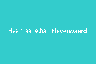 image by Gerard van der Vaart, 11 Feb 2001
Former Waterschap: Noordoostpolder
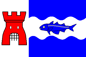 image by Gerard van der Vaart, 11 Feb 2001
Hosted by: Fanshop-Online.de und Handy-Shop.de
Tipp: Apple iPhone 12 im Shop

![[De Runde polderboard]](../images/n/nl~pb-ru.gif) image by Jarig Bakker, 2 Dec 2003
image by Jarig Bakker, 2 Dec 2003
 image by Gerard van der Vaart, 11 Feb 2001
 image by Gerard van der Vaart, 11 Feb 2001
 image by Gerard van der Vaart, 11 Feb 2001
 image by Gerard van der Vaart, 11 Feb 2001
 image by Gerard van der Vaart, 11 Feb 2001
 image by Gerard van der Vaart, 11 Feb 2001
 image by Gerard van der Vaart, 11 Feb 2001
 image by Gerard van der Vaart, 11 Feb 2001
 image by Gerard van der Vaart, 11 Feb 2001